Photograph · real location
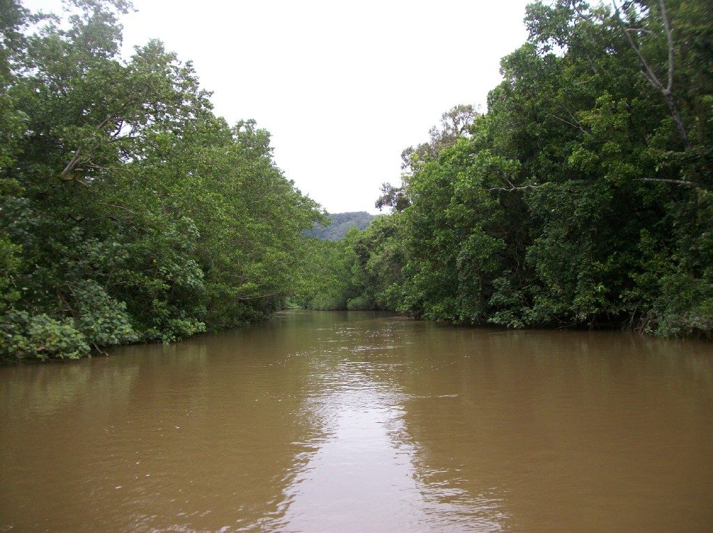
Lower Daintree River
A reach of the lower Daintree River where riverbank repair and mangrove recovery are already under way after Cyclone Jasper.
Real location and documented needs. No Eden site or partnership confirmed.
What the published record says.
Terrain NRM describes riverbank erosion on this reach worsened by Cyclone Jasper in 2023, engineered and revegetation repairs since, and continuing mangrove recovery after flooding. Its project involves Douglas Shire Council and Jabalbina Rangers.
Published April 2026. Part of this reach has already been treated by others; it is not untouched or untreated.
At a glance
- Status
- Research candidate
- Location
- Daintree ferry reach — Far North Queensland, Australia
- Climate
- Rainforest
- Proposed mission
- Rainforest & reef
- Stay length in the simulation
- Seven nights
- Cohort size in the simulation
- 20–30 guests
- Guest contribution, if agreed
- 8–12 hours per stay
The places on this site are real, and the environmental evidence is cited. Eden hospitality, prices, availability, booking, Impact Passport activity and Impact Credits are simulations. Nothing is bookable and no payment is ever taken.
Riparian and mangrove recovery with Traditional Owner governance
What we would propose here, if local partners wanted it. Nothing below has been agreed.
Proposed environmental focus
Extend locally selected riparian and mangrove monitoring and maintenance, and reduce sediment reaching the reef lagoon.
Proposed community focus
Regional employment and ranger pathways, subject to Traditional Owner invitation and governance.
What could be useful here.
For the place
- Safe authorised planting and weed maintenance
- Plant survival and mangrove recovery records
- Water-clarity and sediment observation
- Nursery support for local revegetation
With the community
- Contracting regional suppliers, growers and services
- Paid ranger and land-management roles held locally
- Youth learning programmes designed with local organisations
- Written benefit-sharing before any activity
- Locally governed benefit-sharing
- Dignified paid employment
- Education & youth training
- Cultural preservation
Indicators, not claims.
Proposed indicators — baseline pending, nothing measured yet. Any baseline would be set by an independent survey agreed locally before work began.
Place indicators
Plant survival on treated bank
Baseline pending
Mangrove recovery extent
Not yet measured
Water clarity and sediment observations
Not yet measured
Community indicators
Paid local roles supported
Baseline pending
Regional procurement value
Not yet measured
Training completed with local providers
Not yet measured
Read, notarranged yet.
We have read the published record for this landscape. We have not selected land, approached an organisation or agreed a single hour of work.
Lower Daintree River — Research candidate
Register interest and we will hold your preferences in this prototype.
How it would feel
The first frame is a photograph of the real landscape. The rest is concept imagery; not documentation of this location or of a built Eden Habitat.
Research candidate means the place is real and the need is documented — not that you can book, and not that anyone has agreed to host us.